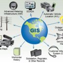
| Geographic Information System is an information system that converts geographic information necessary for human life into computer data and utilizes it efficiently.
The information system is a system that can collect, observe, measure, input into a computer, store, manage, analyze, and reflect stored information in decision making, and provide various types of information, such as maps, charts, and pictures, by integrating and managing spatial data, attribute data, and temporal data on objects with geographic locations. In other words, in a broad sense, GIS refers to a system for a series of operations from observation and collection of geographic information necessary to support human decision-making ability to preserve, analyze, and output. 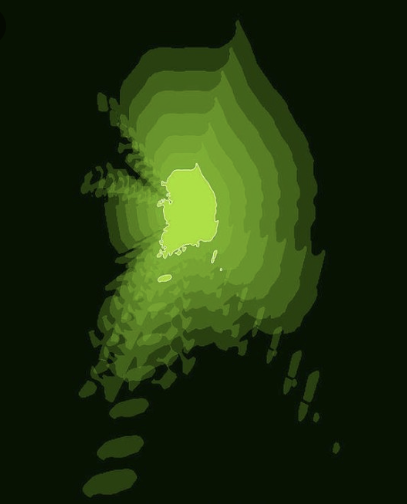
It can be said that the beginning of the history of the GIS began with the production of Thematic Mapping. An example is a map of the number of cholera deaths in London, created in 1854 by Professor John Snow of the United Kingdom. The theme map can be viewed as an ancestor of the GIS in that it was made available for specific purposes by displaying specific information on the map.
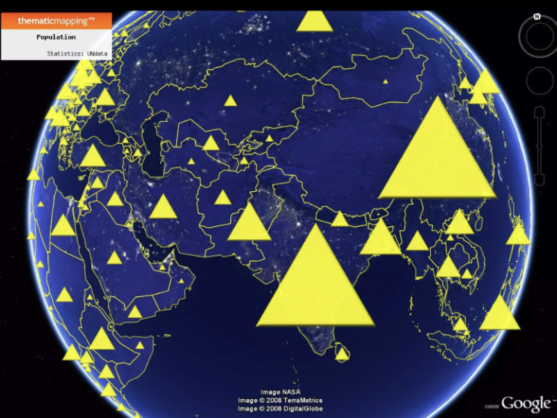
<Example of Thematic Mapping>
Computer modeling and spatial analysis became possible as computer technology developed in the 20th century. Canada Geographic Information System (GIS), the world's first computerized GIS was established in 1963 under the leadership of Dr. Roger Tomlinson of a research institute affiliated with the Canadian government, and it was a system that collected, managed, and analyzed land across Canada by dividing it into seven grades, excluding the frozen ground in the north. This allowed land-related laws to be systematically enacted and land resources to be managed more efficiently.
Entering the 1970s, with the full-scale spread of computers, universities became able to actively utilize GIS. GIS was mainly used in the fields of resources, environment, and public facility management. In addition, the LANDSAT 1 satellite launched in 1972 played a pivotal role in acquiring GIS data.
Later, with the spread of PCs, GIS began to become popular, and recently, with the advent of GIS servers, GIS analysis functions can be used even using Internet browsers. In the early days, the purpose of GIS was mainly to build databases, but now the perspective has shifted to providing application services.
GIS Use Cases
GIS has a wide range of applications because it handles all data closely related to human real life. The fields of use of GIS are rapidly developing across various industries ranging from land, resources, urban, environment, transportation, agriculture, ocean and defense.
With the development of commercial drones, satellite photographs that may not be available for the desired data, or relatively cheap drones are purchased and filmed directly instead of hiring a photograph-only plane at a high price.
Those who use GIS can be divided into three main categories. It is a group of GIS data viewers, GIS data analysts and cartographers (Data Editor), and administrators/developers who build and manage GIS platforms.
In the case of engines developed by Google, Naver, and Kakao, it is a 3rd party GIS engine that focuses on solid and individual. However, as it is heavy and expensive to use in companies, Korean companies have developed a company-centered GIS engine. In the case of Hyundai AutoEver, it has developed a HAE-GIS engine that increases accessibility and optimizes so that simple types of GIS information can be visualized by collecting only functions that are often used in work. The HAE-GIS engine has functions necessary for work such as the ability to organize and operate coordinates and maps in space, the ability to analyze space, and the ability to index and search.
When transporting materials from a logging site in the middle of a forest to a nearby sawmill, the most efficient way can be found. By combining soil data that can withstand the weight of various vegetation, altitudes, and transport vehicles, it is possible to automatically find the most efficient path. This is because the shortest distance is often much more expensive due to various obstacles.
Satellite imagery accumulated over the past 50 years provides a quick glimpse of how a particular region has developed and in which direction it has spread. It is also possible to visually grasp damage in areas that are not easily accessible due to natural disasters such as floods. GIS workers from all over the world donated their talents online to assist rescue and damage recovery efforts during the 2010 Haiti earthquake.
When a franchise company selects a new store location, it can combine various data to select the best location. In this case, it is highly likely that unexpected variables will be found during the selection stage.
Evolution and Applications of Geographic Information Systems (GIS)
- Early Stages:
- Thematic Mapping: GIS's origins can be traced back to thematic maps, which displayed specific information for particular purposes. John Snow's cholera death map in London (1854) is a prime example.
- Computerized GIS: The first computerized GIS, "Canada Geographic Information System," was established in 1963, revolutionizing land management and resource analysis.
- Expansion and Development:
- University Adoption: Universities began actively using GIS in the 1970s, primarily in fields like resources, environment, and public facility management.
- Satellite Data Integration: The launch of LANDSAT 1 in 1972 provided crucial GIS data, expanding its scope and applications.
- Personal Computer Revolution: GIS gained popularity with the spread of personal computers, and later, with the emergence of GIS servers, analysis capabilities became accessible via internet browsers.
- Modern Applications and Uses:
- Diverse Applications: GIS is used across a wide range of fields, including land, resources, urban planning, environment, transportation, agriculture, oceanography, and defense.
- Data Collection and Analysis: Modern GIS systems incorporate drone technology and satellite imagery for efficient data collection and analysis.
- User Roles: GIS professionals fall into three main categories: GIS data viewers, data analysts/cartographers, and administrators/developers.
- GIS in Action:
- Efficient Route Planning: GIS can optimize transportation routes by analyzing factors like terrain, soil conditions, and vehicle capacity.
- Disaster Response: Satellite imagery and GIS data analysis can help assess damage and facilitate rescue efforts in disaster zones.
- Business Decision Making: GIS assists companies in selecting optimal locations for new stores or franchises by analyzing diverse data sets and identifying potential variables.
Key Takeaways: Geographic Information Systems (GIS)
- GIS is a powerful tool that transforms geographic data into actionable information. It collects, analyzes, manages, and displays spatial data to support informed decision-making.
- The origins of GIS lie in thematic mapping, with John Snow's cholera death map serving as a pioneering example.
- Computer technology revolutionized GIS, leading to the development of the first computerized system in 1963.
- GIS has evolved from a data management tool to a platform for diverse applications across various fields.
- Modern GIS systems leverage satellite imagery, drone technology, and web-based platforms for efficient data collection and analysis.
- GIS plays a vital role in planning, management, and decision-making in areas such as resource management, disaster response, and business operations.
|